The Witness House Project
Compare the built environment of Lincoln in 1775 to what remains of it today.
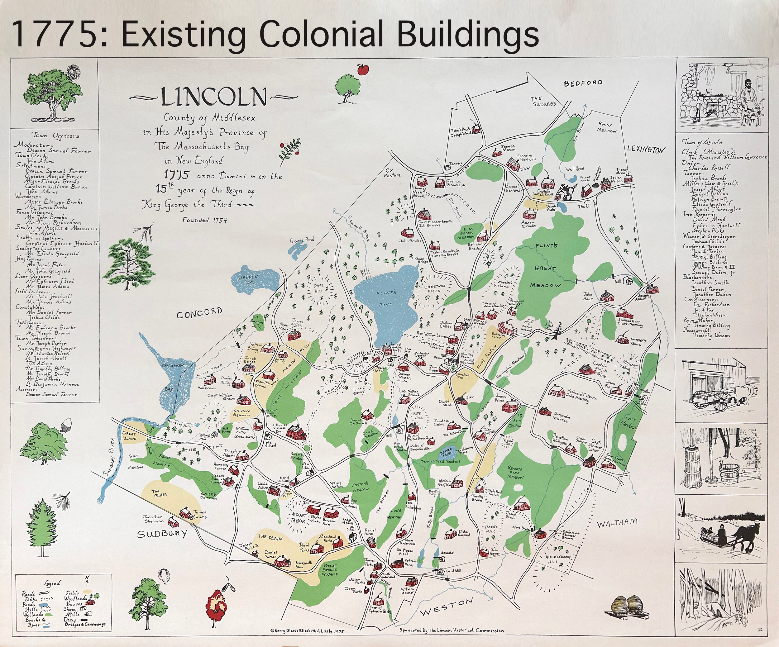
In 1975, after eight years of meticulous research, Elizabeth Little and Kerry Glass drafted a map that traces the early development of the town and its roadways. Originally created with the support of the Historical Commission in anticipation of the 200th anniversary of April 19, 1775, the full-sized map now hangs in the Lincoln Town Offices.
Many of the homes and landmarks shown on the map still stand today, offering a fascinating glimpse into Lincoln’s past.
Can you guess how many homes there were in Lincoln in 1775 and how many of them remain standing today?
To get a closer look, visit the Lincoln Historical Society Bookstore where there are large scale printed maps for sale.